Calpe Map
Interactive Calpe map, useful for visitors and residents to the resort on the Costa Blanca, Spain.
Detailed Street Map of Calpe Costa Blanca
Calpe Map - Street Map of Calpe Spain: Above is a detailed street map of Calpe a popular seaside resort on the northern Costa Blanca, Spain.
The map is 'zoomable' and 'pans' so that you can zoom in for a more detailed street plan of Calpe or view any of the surrounding towns and villages, which include Moraira, Teulada, Altea, Javea, Benidorm and Callosa D'En Sarria.
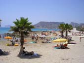
Calpe has a good selection of hotels
Calpe is located off the N-332 and the A-7 (E-15 motorway) about 75 kilometres north of Alicante airport.
Calpe Pages: HOME - WEATHER - PICTURES
More Costa Blanca Resorts: Denia - Javea - Benidorm - Altea - Villajoyosa - Cabo Roig
HOME